


Roche St Secret - Le Rachas 12km

thonyc
User GUIDE
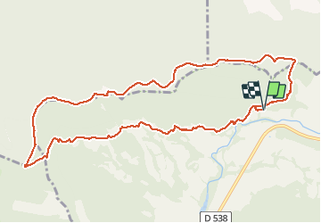

Length
12 km

Max alt
894 m

Uphill gradient
608 m
Km-Effort
20 km

Min alt
379 m

Downhill gradient
608 m
Boucle
Yes
Creation date :
2021-05-06 07:52:53.505
Updated on :
2021-05-06 15:42:16.933
4h00
Difficulty : Medium

FREE GPS app for hiking
 SityTrail
IGN / Geographical institutes
SityTrail Plus
The world is yours!
About
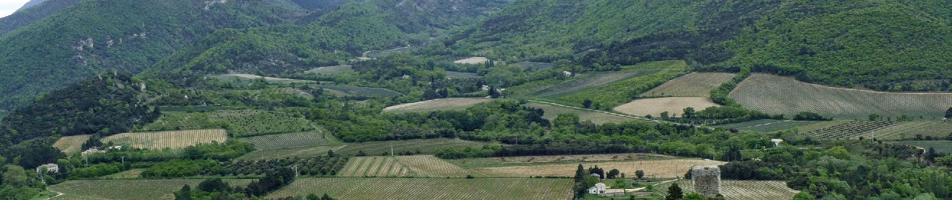
Trail Walking of 12 km to be discovered at Auvergne-Rhône-Alpes, Drôme, Roche-Saint-Secret-Béconne. This trail is proposed by thonyc.
Description
Très belle rando.
Entre le départ et la tour d'Alençon, la trace gps est calée sur le balisage PR. Ce sentier n'existe pas sur la carte IGN.
Photos

Positioning
Country:
France
Region :
Auvergne-Rhône-Alpes
Department/Province :
Drôme
Municipality :
Roche-Saint-Secret-Béconne
Location:
Unknown
Start:(Dec)
Start:(UTM)
662364 ; 4929463 (31T) N.
Comments