


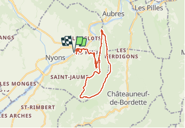
L'Essaillon

MarcLEBARON
User

Length
17.2 km

Max alt
933 m

Uphill gradient
915 m
Km-Effort
29 km

Min alt
266 m

Downhill gradient
915 m
Boucle
Yes
Creation date :
2021-05-06 07:14:41.262
Updated on :
2021-05-07 08:40:00.688
5h22
Difficulty : Difficult

FREE GPS app for hiking
 SityTrail
IGN / Geographical institutes
SityTrail Plus
The world is yours!
About
Trail Walking of 17.2 km to be discovered at Auvergne-Rhône-Alpes, Drôme, Nyons. This trail is proposed by MarcLEBARON.
Description
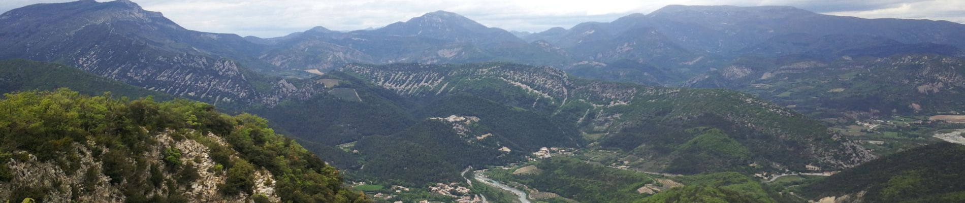
Boucle au dessus de Nyons en logeant la montagne de l'Essaillon.
Superbes points de vues.
Possibilité d'éviter la partie basse dans les rues, en commençant vers le km 2.5.
Photos


Positioning
Country:
France
Region :
Auvergne-Rhône-Alpes
Department/Province :
Drôme
Municipality :
Nyons
Location:
Unknown
Start:(Dec)
Start:(UTM)
670650 ; 4913812 (31T) N.
Comments
