


Chezery Crêt Chalam (IBP 95) 7 mai 2021 CAF

TRIMAILLE
User
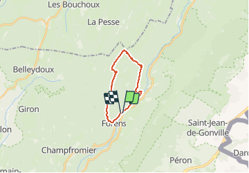

Length
17 km

Max alt
1524 m

Uphill gradient
965 m
Km-Effort
30 km

Min alt
581 m

Downhill gradient
966 m
Boucle
Yes
Creation date :
2021-05-07 07:44:20.764
Updated on :
2021-05-09 17:29:43.714
5h47
Difficulty : Difficult

FREE GPS app for hiking
 SityTrail
IGN / Geographical institutes
SityTrail Plus
The world is yours!
About
Trail Walking of 17 km to be discovered at Auvergne-Rhône-Alpes, Ain, Chézery-Forens. This trail is proposed by TRIMAILLE.
Description
Départ du parking de l'église de Chezery
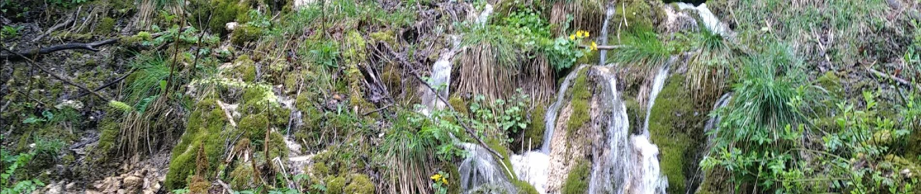
Photos
 7 mai 2021 CAF - Photo 1")
 7 mai 2021 CAF - Photo 2")
 7 mai 2021 CAF - Photo 3")
 7 mai 2021 CAF - Photo 4")
 7 mai 2021 CAF - Photo 5")
Positioning
Country:
France
Region :
Auvergne-Rhône-Alpes
Department/Province :
Ain
Municipality :
Chézery-Forens
Location:
Unknown
Start:(Dec)
Start:(UTM)
721096 ; 5122698 (31T) N.
Comments