Trail Walking Issoire - Issoire - Perriers - Issoire - Photo

Issoire - Perriers - Issoire

 GilGry
GilGry

User

© OpenStreetMap contributors
Length
Length
11 km
Max alt
Max alt
581 m
Uphill gradient
Uphill gradient
211 m
Km-Effort
Km-Effort  
13.8 km
Min alt
Min alt
389 m
Downhill gradient
Downhill gradient
211 m
Boucle
Boucle
Yes
Creation date :
2021-05-07 21:15:17.186
Updated on :
2021-05-08 08:32:15.465

(0 Reviews)

Walking
Walking
4h17
Difficulty : Medium

Scan this QR Code to open this trail in the SityTrail application

FREE GPS app for hiking

Logo SityTrail SityTrail

IGN / Geographical institutes

Download SityTrail from the App Store Download SityTrail from Google Play

Logo SityTrail SityTrail World

The world is yours!

Download SityTrail from the App Store Download SityTrail from Google Play Download SityTrail on Huawei AppGallery

About

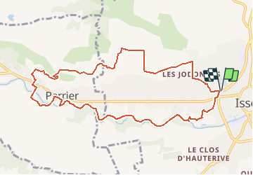
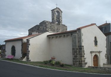
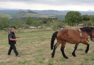
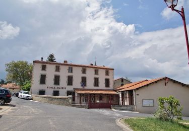
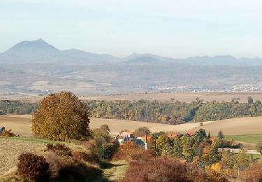
Trail Walking of 11 km to be discovered at Auvergne-Rhône-Alpes, Puy-de-Dôme, Issoire. This trail is proposed by GilGry.

Description

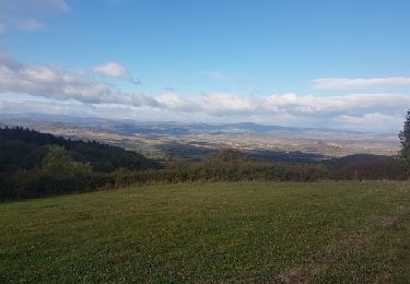
Visite du site des grottes. Retour le long de la Couze Pavin.           ( Parfois en hors piste mais rien de méchant )

Elevation profile

Positioning

Country:
France
Region :
Auvergne-Rhône-Alpes
Department/Province :
Puy-de-Dôme
Municipality :
Issoire
Location:
Unknown
Start:(UTM)
518912 ; 5043581 (31T) N.

Trails nearby

Trail Motor Issoire - monboissiers 2 - Photo
Motor
coppel

Motor

Medium
(1)
Issoire, Auvergne-Rhône-Alpes, Puy-de-Dôme, France
101 km | 129 km-effort
3h 0min
Yes
Trail Walking Les Pradeaux - De l'Allier à l'Ailloux - Photo
Walking
tracegps

Walking

Medium
(1)
Les Pradeaux, Auvergne-Rhône-Alpes, Puy-de-Dôme, France
11.5 km | 13.1 km-effort
3h 0min
Yes
Trail On foot Aulhat-Flat - De fontaines en lavoirs - Photo
On foot
PRO

On foot

Medium
Aulhat-Flat, Auvergne-Rhône-Alpes, Puy-de-Dôme, France
14.7 km | 21 km-effort
4h 51min
Yes
Trail On foot Perrier - Chaux de Pardines et Grottes de Perrier - Photo
On foot
PRO

On foot

Easy
Perrier, Auvergne-Rhône-Alpes, Puy-de-Dôme, France
12 km | 15.6 km-effort
3h 33min
Yes
Trail On foot Orbeil - Le Domaine de Vort - Photo
On foot
PRO

On foot

Easy
Orbeil, Auvergne-Rhône-Alpes, Puy-de-Dôme, France
8.8 km | 12.1 km-effort
2h 45min
Yes
Trail On foot Sauvagnat-Sainte-Marthe - Le Puy Neyrand - Photo
On foot
PRO

On foot

Easy
Sauvagnat-Sainte-Marthe, Auvergne-Rhône-Alpes, Puy-de-Dôme, France
5.7 km | 8 km-effort
1h 48min
Yes
Trail Motorbike Issoire - Rando ST Flour - Photo
Motorbike
coppel

Motorbike

Medium
Issoire, Auvergne-Rhône-Alpes, Puy-de-Dôme, France
227 km | 298 km-effort
7h 23min
Yes
Trail Moto cross Issoire - Sortie Ally avec cailloux et Olivier - Photo
Moto cross
coppel

Moto cross

Difficult
Issoire, Auvergne-Rhône-Alpes, Puy-de-Dôme, France
196 km | 253 km-effort
Unknown
No
Trail Walking Sauvagnat-Sainte-Marthe - ITI0579 - Photo
Walking
GUIDE
jagarnier

Walking

Easy
Sauvagnat-Sainte-Marthe, Auvergne-Rhône-Alpes, Puy-de-Dôme, France
6.1 km | 9.4 km-effort
1h 45min
Yes


Close
My subscriptions