


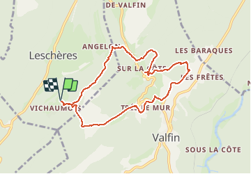
Vichaumois-Valfin

micheldutilleul
User

Length
8.5 km

Max alt
913 m

Uphill gradient
318 m
Km-Effort
12.7 km

Min alt
736 m

Downhill gradient
314 m
Boucle
Yes
Creation date :
2021-05-08 09:26:29.406
Updated on :
2021-05-13 10:36:41.177
2h14
Difficulty : Easy

FREE GPS app for hiking
 SityTrail
IGN / Geographical institutes
SityTrail Plus
The world is yours!
About
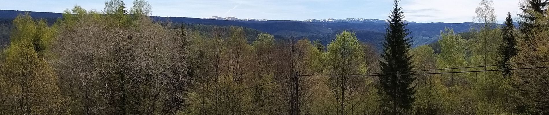
Trail Walking of 8.5 km to be discovered at Bourgogne-Franche-Comté, Jura, Leschères. This trail is proposed by micheldutilleul.
Photos

Positioning
Country:
France
Region :
Bourgogne-Franche-Comté
Department/Province :
Jura
Municipality :
Leschères
Location:
Unknown
Start:(Dec)
Start:(UTM)
717260 ; 5147210 (31T) N.
Comments