


2021 05 Arbonne R1

michel1025
User

Length
46 km

Max alt
127 m

Uphill gradient
468 m
Km-Effort
52 km

Min alt
44 m

Downhill gradient
490 m
Boucle
No
Creation date :
2021-05-08 11:44:00.0
Updated on :
2021-05-08 15:30:32.899
2h58
Difficulty : Difficult

FREE GPS app for hiking
 SityTrail
IGN / Geographical institutes
SityTrail Plus
The world is yours!
About
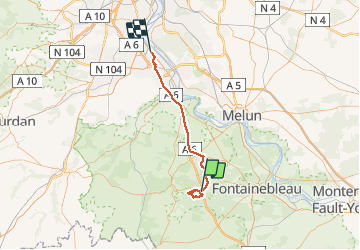
Trail Walking of 46 km to be discovered at Ile-de-France, Seine-et-Marne, Arbonne-la-Forêt. This trail is proposed by michel1025.
Positioning
Country:
France
Region :
Ile-de-France
Department/Province :
Seine-et-Marne
Municipality :
Arbonne-la-Forêt
Location:
Unknown
Start:(Dec)
Start:(UTM)
466471 ; 5360987 (31U) N.
Comments