


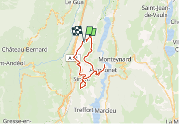
St Martin de la Cluze - Point de vue Barrage de Monteynard

maupassant38
User

Length
23 km

Max alt
850 m

Uphill gradient
580 m
Km-Effort
31 km

Min alt
569 m

Downhill gradient
576 m
Boucle
Yes
Creation date :
2021-05-12 08:43:16.241
Updated on :
2021-05-12 11:42:38.914
2h07
Difficulty : Medium

FREE GPS app for hiking
 SityTrail
IGN / Geographical institutes
SityTrail Plus
The world is yours!
About
Trail Mountain bike of 23 km to be discovered at Auvergne-Rhône-Alpes, Isère, Saint-Martin-de-la-Cluze. This trail is proposed by maupassant38.
Positioning
Country:
France
Region :
Auvergne-Rhône-Alpes
Department/Province :
Isère
Municipality :
Saint-Martin-de-la-Cluze
Location:
Unknown
Start:(Dec)
Start:(UTM)
709690 ; 4984391 (31T) N.
Comments