


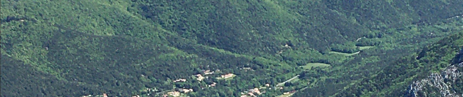
Le Caunil. Maison forestière par Puylaurens

robertperello
User
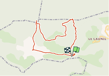

Length
10 km

Max alt
1479 m

Uphill gradient
470 m
Km-Effort
16.2 km

Min alt
1033 m

Downhill gradient
468 m
Boucle
Yes
Creation date :
2021-05-12 08:00:00.0
Updated on :
2021-05-12 13:03:32.815
2h45
Difficulty : Difficult

FREE GPS app for hiking
 SityTrail
IGN / Geographical institutes
SityTrail Plus
The world is yours!
About
Trail Walking of 10 km to be discovered at Occitania, Aude, Salvezines. This trail is proposed by robertperello.
Description
470 m de dénivelé très raide
Photos


Positioning
Country:
France
Region :
Occitania
Department/Province :
Aude
Municipality :
Salvezines
Location:
Unknown
Start:(Dec)
Start:(UTM)
441051 ; 4735881 (31T) N.
Comments