


Pierre Chauve

okfred26
User
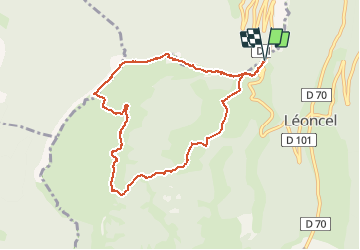

Length
8.9 km

Max alt
1299 m

Uphill gradient
373 m
Km-Effort
13.9 km

Min alt
1034 m

Downhill gradient
373 m
Boucle
Yes
Creation date :
2021-05-13 08:33:54.013
Updated on :
2021-05-13 17:19:37.528
3h14
Difficulty : Easy

FREE GPS app for hiking
 SityTrail
IGN / Geographical institutes
SityTrail Plus
The world is yours!
About
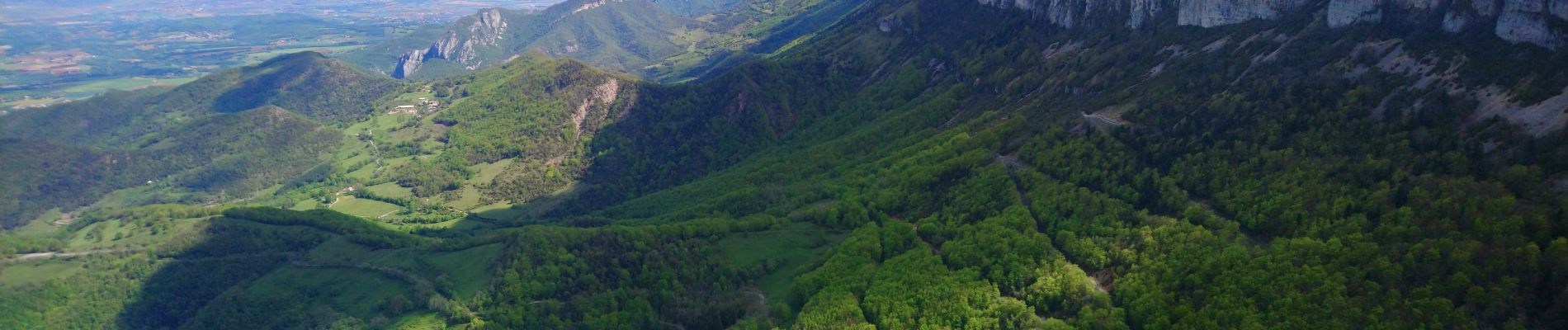
Trail Walking of 8.9 km to be discovered at Auvergne-Rhône-Alpes, Drôme, Léoncel. This trail is proposed by okfred26.
Photos


Positioning
Country:
France
Region :
Auvergne-Rhône-Alpes
Department/Province :
Drôme
Municipality :
Léoncel
Location:
Unknown
Start:(Dec)
Start:(UTM)
672427 ; 4976227 (31T) N.
Comments