


2021-05-13_17h16m26_cirque de CHAMALIERES

jpcccb
User
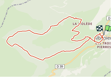

Length
12.9 km

Max alt
1445 m

Uphill gradient
489 m
Km-Effort
19.4 km

Min alt
1041 m

Downhill gradient
489 m
Boucle
Yes
Creation date :
2021-05-13 15:16:27.042
Updated on :
2021-09-14 16:09:07.082
4h24
Difficulty : Very difficult

FREE GPS app for hiking
 SityTrail
IGN / Geographical institutes
SityTrail Plus
The world is yours!
About
Trail Walking of 12.9 km to be discovered at Auvergne-Rhône-Alpes, Cantal, Albepierre-Bredons. This trail is proposed by jpcccb.
Positioning
Country:
France
Region :
Auvergne-Rhône-Alpes
Department/Province :
Cantal
Municipality :
Albepierre-Bredons
Location:
Unknown
Start:(Dec)
Start:(UTM)
486849 ; 4991551 (31T) N.
Comments