


Meung sur loire_St Ay

lemuid
User
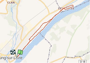

Length
8.3 km

Max alt
105 m

Uphill gradient
70 m
Km-Effort
9.3 km

Min alt
84 m

Downhill gradient
70 m
Boucle
Yes
Creation date :
2021-05-13 16:39:57.168
Updated on :
2021-05-13 16:46:04.011
2h03
Difficulty : Easy

FREE GPS app for hiking
 SityTrail
IGN / Geographical institutes
SityTrail Plus
The world is yours!
About
Trail Walking of 8.3 km to be discovered at Centre-Loire Valley, Loiret, Meung-sur-Loire. This trail is proposed by lemuid.
Positioning
Country:
France
Region :
Centre-Loire Valley
Department/Province :
Loiret
Municipality :
Meung-sur-Loire
Location:
Unknown
Start:(Dec)
Start:(UTM)
402929 ; 5297868 (31T) N.
Comments