


Terneze-2021-05-08

Valmeinier
User
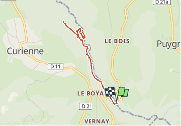

Length
4.4 km

Max alt
649 m

Uphill gradient
126 m
Km-Effort
6.1 km

Min alt
569 m

Downhill gradient
126 m
Boucle
Yes
Creation date :
2021-05-14 07:18:07.228
Updated on :
2021-05-14 07:21:20.691
1h22
Difficulty : Very easy

FREE GPS app for hiking
 SityTrail
IGN / Geographical institutes
SityTrail Plus
The world is yours!
About
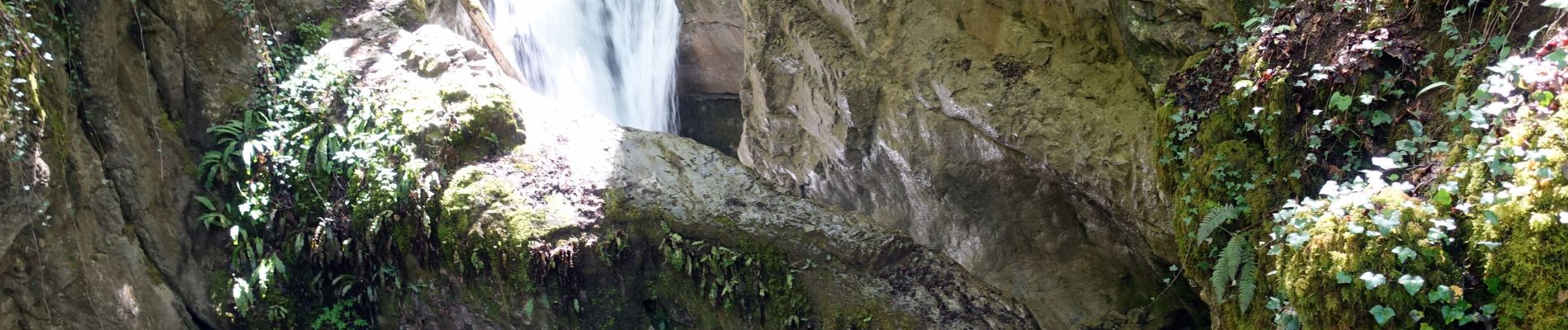
Trail Walking of 4.4 km to be discovered at Auvergne-Rhône-Alpes, Savoy, Curienne. This trail is proposed by Valmeinier.
Photos


Positioning
Country:
France
Region :
Auvergne-Rhône-Alpes
Department/Province :
Savoy
Municipality :
Curienne
Location:
Unknown
Start:(Dec)
Start:(UTM)
267791 ; 5049477 (32T) N.
Comments