


rando Vosges Mai 2021

micheldutilleul
User
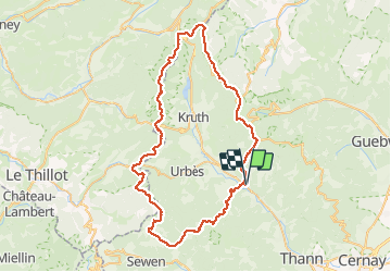

Length
73 km

Max alt
1268 m

Uphill gradient
3206 m
Km-Effort
116 km

Min alt
401 m

Downhill gradient
3203 m
Boucle
Yes
Creation date :
2021-05-13 10:27:30.263
Updated on :
2021-05-15 14:21:53.831
20h31
Difficulty : Medium

FREE GPS app for hiking
 SityTrail
IGN / Geographical institutes
SityTrail Plus
The world is yours!
About
Trail Walking of 73 km to be discovered at Grand Est, Haut-Rhin, Saint-Amarin. This trail is proposed by micheldutilleul.
Positioning
Country:
France
Region :
Grand Est
Department/Province :
Haut-Rhin
Municipality :
Saint-Amarin
Location:
Unknown
Start:(Dec)
Start:(UTM)
352867 ; 5304045 (32T) N.
Comments