Trail Walking Criel-sur-Mer - w-frankrijk-de-krijtrotsen-van-ciel-sur-mer - Photo

w-frankrijk-de-krijtrotsen-van-ciel-sur-mer

© OpenStreetMap contributors
Length
Length
9.5 km
Max alt
Max alt
111 m
Uphill gradient
Uphill gradient
210 m
Km-Effort
Km-Effort  
12.3 km
Min alt
Min alt
6 m
Downhill gradient
Downhill gradient
210 m
Boucle
Boucle
Yes
Creation date :
2014-12-10 00:00:00.0
Updated on :
2014-12-10 00:00:00.0

(0 Reviews)

Walking
Walking
--
Difficulty : Unknown

Scan this QR Code to open this trail in the SityTrail application

FREE GPS app for hiking

Logo SityTrail SityTrail

IGN / Geographical institutes

Download SityTrail from the App Store Download SityTrail from Google Play

Logo SityTrail SityTrail World

The world is yours!

Download SityTrail from the App Store Download SityTrail from Google Play Download SityTrail on Huawei AppGallery

About

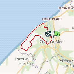
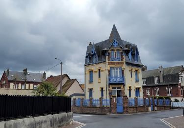
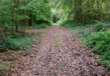
Trail Walking of 9.5 km to be discovered at Normandy, Seine-Maritime, Criel-sur-Mer. This trail is proposed by gpstracks.

Description

More information on GPStracks.nl : http://www.gpstracks.nl

Elevation profile

Points of interest

Point of interest Criel-sur-Mer - aansluitpunt GR route - Photo
gpstracks
CRIEL-SUR-MER 
Point of interest Criel-sur-Mer - Bunker Atlantik wall - Photo
gpstracks
CRIEL-SUR-MER 
Point of interest Criel-sur-Mer - Manoir de Briancon - Photo
gpstracks
CRIEL-SUR-MER 
Point of interest Criel-sur-Mer - Picnicktafel - Photo
gpstracks
CRIEL-SUR-MER 
Point of interest Criel-sur-Mer - Trappen - Photo
gpstracks
CRIEL-SUR-MER 
Point of interest Criel-sur-Mer - Uitzichtpunt en picnickplek - Photo
gpstracks

Positioning

Country:
France
Region :
Normandy
Department/Province :
Seine-Maritime
Municipality :
Criel-sur-Mer
Location:
Unknown
Start:(UTM)
379353 ; 5541937 (31U) N.

Trails nearby

Trail Walking Criel-sur-Mer - Le Mont Jolibois - Criel sur Mer - Photo
Walking
tracegps

Walking

Medium
(2)
Criel-sur-Mer, Normandy, Seine-Maritime, France
12.4 km | 15.9 km-effort
3h 4min
Yes
Trail Cycle Criel-sur-Mer - Boucle vélo de l'Yéres - Criel sur Mer - Photo
Cycle
tracegps

Cycle

Easy
(1)
Criel-sur-Mer, Normandy, Seine-Maritime, France
22 km | 24 km-effort
1h 30min
Yes
Trail Walking Le Tréport - La plaine de La Falaise - Le Tréport - Photo
Walking
tracegps

Walking

Medium
(1)
Le Tréport, Normandy, Seine-Maritime, France
10.4 km | 13.4 km-effort
2h 30min
Yes
Trail On foot Criel-sur-Mer - Criel-sur-Mer et ses alentours - Photo
On foot
rvs147

On foot

Very easy
(1)
Criel-sur-Mer, Normandy, Seine-Maritime, France
14.8 km | 17.4 km-effort
Unknown
Yes
Trail On foot Criel-sur-Mer - Sang-Roy - Photo
On foot
PRO

On foot

Easy
Criel-sur-Mer, Normandy, Seine-Maritime, France
5.4 km | 6.4 km-effort
1h 27min
No
Trail On foot Criel-sur-Mer - Les Falaises de Criel-sur-Mer - Photo
On foot
PRO

On foot

Easy
Criel-sur-Mer, Normandy, Seine-Maritime, France
4.4 km | 5.4 km-effort
1h 13min
No
Trail Walking Le Tréport - Balade le Tréport et Mers les bains - Photo
Walking
chessyca

Walking

Medium
Le Tréport, Normandy, Seine-Maritime, France
9.4 km | 11.7 km-effort
2h 51min
No
Trail Walking Saint-Martin-le-Gaillard - st Sulpice - Photo
Walking
Brindille

Walking

Easy
Saint-Martin-le-Gaillard, Normandy, Seine-Maritime, France
12.7 km | 16.1 km-effort
3h 38min
Yes
Trail Mountain bike Le Tréport - Chemin des étangs de la vallée de la Bresle - Le Tréport - Photo
Mountain bike
tracegps

Mountain bike

Easy
Le Tréport, Normandy, Seine-Maritime, France
17.8 km | 19.2 km-effort
1h 30min
No


Close
My subscriptions