


CAP FERRAT

Daniel Benteux
User
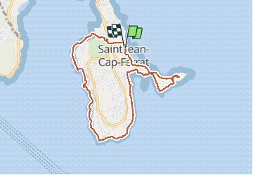

Length
9.1 km

Max alt
47 m

Uphill gradient
226 m
Km-Effort
12.1 km

Min alt
-1 m

Downhill gradient
225 m
Boucle
Yes
Creation date :
2021-05-20 09:21:36.851
Updated on :
2021-05-20 12:43:29.154
2h36
Difficulty : Easy

FREE GPS app for hiking
 SityTrail
IGN / Geographical institutes
SityTrail Plus
The world is yours!
About
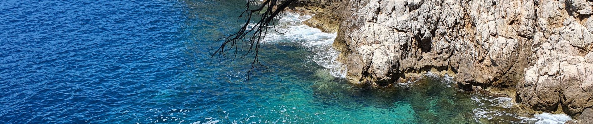
Trail Walking of 9.1 km to be discovered at Provence-Alpes-Côte d'Azur, Maritime Alps, Saint-Jean-Cap-Ferrat. This trail is proposed by Daniel Benteux.
Description
marche
Photos


Positioning
Country:
France
Region :
Provence-Alpes-Côte d'Azur
Department/Province :
Maritime Alps
Municipality :
Saint-Jean-Cap-Ferrat
Location:
Unknown
Start:(Dec)
Start:(UTM)
365682 ; 4838930 (32T) N.
Comments