


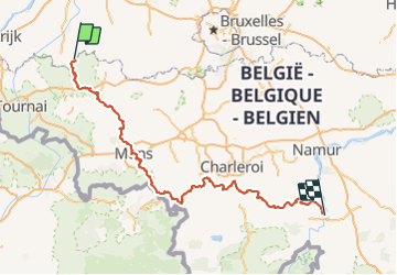
GR129_Parcours-Principal_2021-02-05

ramagufa
User

Length
194 km

Max alt
283 m

Uphill gradient
2863 m
Km-Effort
232 km

Min alt
26 m

Downhill gradient
2823 m
Boucle
No
Creation date :
2021-05-21 17:17:06.891
Updated on :
2022-02-02 12:37:27.31
52h48
Difficulty : Very difficult

FREE GPS app for hiking
 SityTrail
IGN / Geographical institutes
SityTrail Plus
The world is yours!
About
Trail Walking of 194 km to be discovered at Flanders, East Flanders, Ronse. This trail is proposed by ramagufa.
Positioning
Country:
Belgium
Region :
Flanders
Department/Province :
East Flanders
Municipality :
Ronse
Location:
Unknown
Start:(Dec)
Start:(UTM)
546308 ; 5622745 (31U) N.
Comments