


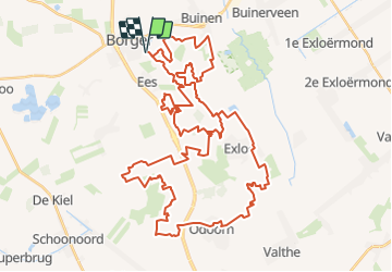
Drenthe - Hondsrugtocht Borger

gpstracks
User

Length
79 km

Max alt
41 m

Uphill gradient
521 m
Km-Effort
86 km

Min alt
8 m

Downhill gradient
521 m
Boucle
Yes
Creation date :
2014-12-10 00:00:00.0
Updated on :
2014-12-10 00:00:00.0
--
Difficulty : Unknown

FREE GPS app for hiking
 SityTrail
IGN / Geographical institutes
SityTrail Plus
The world is yours!
About
Trail Mountain bike of 79 km to be discovered at Drenthe, Unknown, Borger-Odoorn. This trail is proposed by gpstracks.
Description
More information on GPStracks.nl : http://www.gpstracks.nl


Positioning
Country:
Netherlands
Region :
Drenthe
Department/Province :
Unknown
Municipality :
Borger-Odoorn
Location:
Unknown
Start:(Dec)
Start:(UTM)
352461 ; 5865471 (32U) N.
Comments