


Autour du camping La Rive

karani27
User
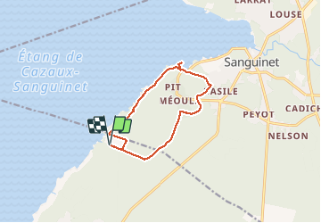

Length
11.3 km

Max alt
38 m

Uphill gradient
79 m
Km-Effort
12.3 km

Min alt
20 m

Downhill gradient
79 m
Boucle
Yes
Creation date :
2021-05-22 12:06:47.644
Updated on :
2021-05-24 20:32:06.458
2h57
Difficulty : Easy

FREE GPS app for hiking
 SityTrail
IGN / Geographical institutes
SityTrail Plus
The world is yours!
About
Trail Walking of 11.3 km to be discovered at New Aquitaine, Landes, Biscarrosse. This trail is proposed by karani27.
Description
Randonnée facile en forêt jusqu'au port de l'étang de Sanguinet
Positioning
Country:
France
Region :
New Aquitaine
Department/Province :
Landes
Municipality :
Biscarrosse
Location:
Unknown
Start:(Dec)
Start:(UTM)
648716 ; 4924718 (30T) N.
Comments