


Morhet

AnneCecile
User
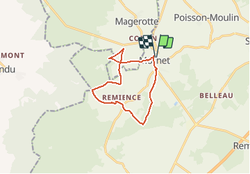

Length
10 km

Max alt
523 m

Uphill gradient
154 m
Km-Effort
12.1 km

Min alt
457 m

Downhill gradient
155 m
Boucle
Yes
Creation date :
2021-05-22 15:24:26.592
Updated on :
2021-05-22 16:25:48.679

FREE GPS app for hiking
 SityTrail
IGN / Geographical institutes
SityTrail Plus
The world is yours!
About
Trail of 10 km to be discovered at Wallonia, Luxembourg, Vaux-sur-Sûre. This trail is proposed by AnneCecile.
Positioning
Country:
Belgium
Region :
Wallonia
Department/Province :
Luxembourg
Municipality :
Vaux-sur-Sûre
Location:
Unknown
Start:(Dec)
Start:(UTM)
685388 ; 5537708 (31U) N.
Comments