


Traversée du vaucluse 3e jours

nouga
User
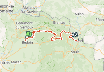

Length
52 km

Max alt
1534 m

Uphill gradient
1853 m
Km-Effort
76 km

Min alt
330 m

Downhill gradient
1408 m
Boucle
No
Creation date :
2021-05-23 07:09:51.561
Updated on :
2021-05-23 16:37:24.141
9h12
Difficulty : Very difficult

FREE GPS app for hiking
 SityTrail
IGN / Geographical institutes
SityTrail Plus
The world is yours!
About
Trail Mountain bike of 52 km to be discovered at Provence-Alpes-Côte d'Azur, Vaucluse, Bédoin. This trail is proposed by nouga.
Description
Ascensio Du mont ventoux Très difficile Beaucoup de cailloux
Positioning
Country:
France
Region :
Provence-Alpes-Côte d'Azur
Department/Province :
Vaucluse
Municipality :
Bédoin
Location:
Unknown
Start:(Dec)
Start:(UTM)
673620 ; 4888801 (31T) N.
Comments