


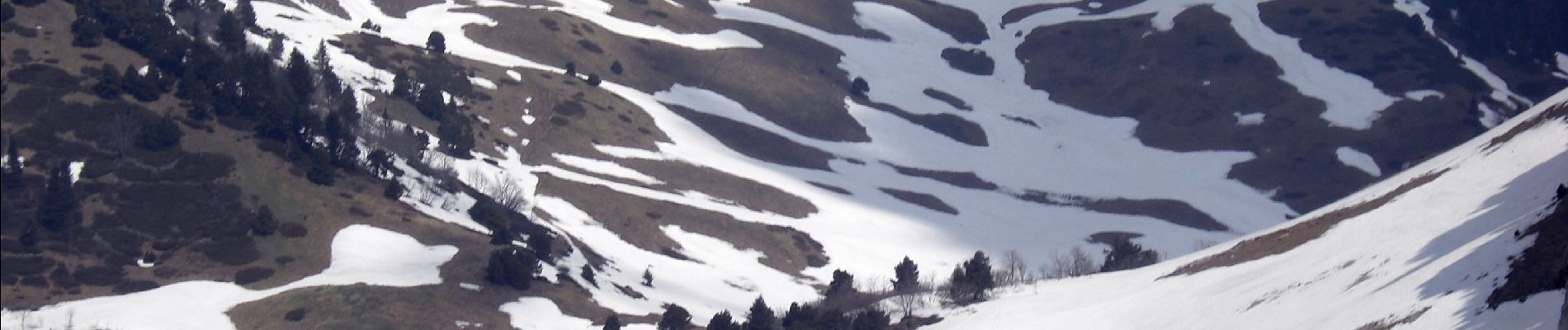
Rochers de Chalves-2021-05-25

Valmeinier
User
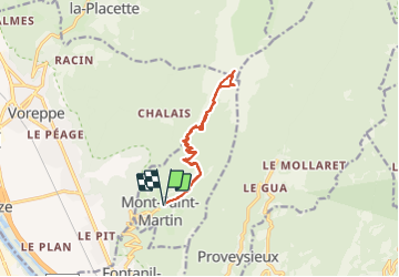

Length
13 km

Max alt
1840 m

Uphill gradient
1050 m
Km-Effort
27 km

Min alt
753 m

Downhill gradient
1048 m
Boucle
Yes
Creation date :
2021-05-25 06:25:16.362
Updated on :
2021-05-27 14:52:27.355
5h25
Difficulty : Medium

FREE GPS app for hiking
 SityTrail
IGN / Geographical institutes
SityTrail Plus
The world is yours!
About
Trail Walking of 13 km to be discovered at Auvergne-Rhône-Alpes, Isère, Mont-Saint-Martin. This trail is proposed by Valmeinier.
Description
Départ Mont Saint Martin
Photos


Positioning
Country:
France
Region :
Auvergne-Rhône-Alpes
Department/Province :
Isère
Municipality :
Mont-Saint-Martin
Location:
Unknown
Start:(Dec)
Start:(UTM)
709893 ; 5016705 (31T) N.
Comments