Trail Walking Jaujac - Jaujac Le Ventapet 14km - Photo

Jaujac Le Ventapet 14km

 thonyc
thonyc

User GUIDE

© OpenStreetMap contributors
Length
Length
13.6 km
Max alt
Max alt
824 m
Uphill gradient
Uphill gradient
731 m
Km-Effort
Km-Effort  
23 km
Min alt
Min alt
368 m
Downhill gradient
Downhill gradient
730 m
Boucle
Boucle
Yes
Creation date :
2021-05-25 08:48:24.274
Updated on :
2023-10-16 08:41:00.499

(1 Reviews)

Walking
Walking
5h18
Difficulty : Very difficult

Scan this QR Code to open this trail in the SityTrail application

FREE GPS app for hiking

Logo SityTrail SityTrail

IGN / Geographical institutes

Download SityTrail from the App Store Download SityTrail from Google Play

Logo SityTrail SityTrail World

The world is yours!

Download SityTrail from the App Store Download SityTrail from Google Play Download SityTrail on Huawei AppGallery

About

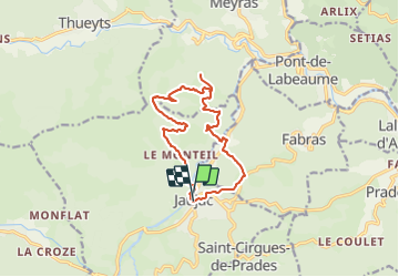
Trail Walking of 13.6 km to be discovered at Auvergne-Rhône-Alpes, Ardèche, Jaujac. This trail is proposed by thonyc.

Description

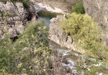
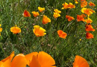
Beaux panoramas. Ne pas hésiter à faire l'aller-retour jusqu'à la table d'interprétation de Serre Rouge.
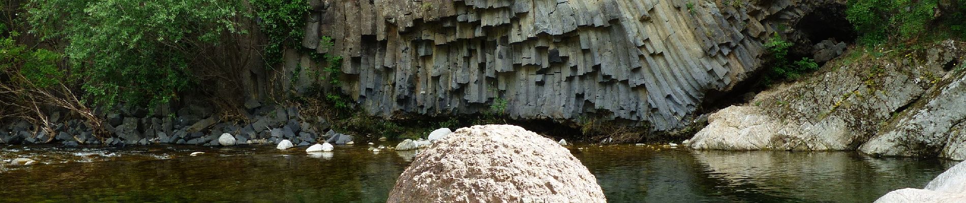
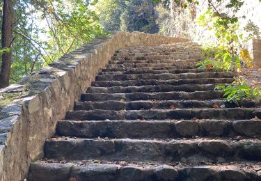
La Coupe de Jaujac, les orgues basaltiques, une leçon de géologie pour le plaisir de tous.

Elevation profile

Photos

Positioning

Country:
France
Region :
Auvergne-Rhône-Alpes
Department/Province :
Ardèche
Municipality :
Jaujac
Location:
Unknown
Start:(UTM)
599543 ; 4943330 (31T) N.

Comments

Please log in to post a review or rate the element


Trails nearby

Trail Walking Fabras - Fabras  - Photo
Walking
MoiClaude

Walking

Medium
(1)
Fabras, Auvergne-Rhône-Alpes, Ardèche, France
6.4 km | 9.7 km-effort
1h 49min
No
Trail Walking Meyras - neyrac les bains - Photo
Walking
raab

Walking

Easy
(1)
Meyras, Auvergne-Rhône-Alpes, Ardèche, France
4.4 km | 6.8 km-effort
1h 36min
Yes
Trail Walking Jaujac - 07_jaujac_Orgues_9km360m - Photo
Walking
SyMA

Walking

Medium
Jaujac, Auvergne-Rhône-Alpes, Ardèche, France
9.1 km | 13.8 km-effort
3h 7min
Yes
Trail Walking Thueyts - 231217 Thueyts-Brige - Photo
Walking
Rudy07

Walking

Easy
(1)
Thueyts, Auvergne-Rhône-Alpes, Ardèche, France
5.7 km | 9.6 km-effort
2h 11min
Yes
Trail Walking La Souche - La Souche : de Montflat au Rocher du Midi avec un retour par les Rudils - Photo
Walking
jeannine grandjean

Walking

Difficult
La Souche, Auvergne-Rhône-Alpes, Ardèche, France
6.8 km | 12.8 km-effort
2h 53min
Yes
Trail Walking Fabras - Fabras Jaujac les orgues basaltiques  - Photo
Walking
GUIDE
Roger Philippe Wallez

Walking

Very difficult
Fabras, Auvergne-Rhône-Alpes, Ardèche, France
14.9 km | 22 km-effort
5h 17min
Yes
Trail Walking Meyras - Balade Neyrac Bas - Neyrac haut - Souihol - Photo
Walking
coureursdecretes

Walking

Medium
(1)
Meyras, Auvergne-Rhône-Alpes, Ardèche, France
5.9 km | 9 km-effort
2h 2min
Yes
Trail Walking Thueyts - Thueyts-Autureyre-4 chemins-La Teyre - Photo
Walking
coureursdecretes

Walking

Medium
Thueyts, Auvergne-Rhône-Alpes, Ardèche, France
13.2 km | 20 km-effort
4h 28min
Yes
Trail Walking Thueyts - Pont du diable Thueyts échelle de la reine  - Photo
Walking
falconvini

Walking

Medium
(1)
Thueyts, Auvergne-Rhône-Alpes, Ardèche, France
5.4 km | 9.3 km-effort
1h 51min
Yes


Close
My subscriptions