Jaujac Le Ventapet 14km

thonyc
User GUIDE
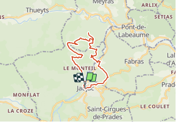

Length
13.6 km

Max alt
824 m

Uphill gradient
731 m
Km-Effort
23 km

Min alt
368 m

Downhill gradient
730 m
Boucle
Yes
Creation date :
2021-05-25 08:48:24.274
Updated on :
2023-10-16 08:41:00.499
5h18
Difficulty : Very difficult

FREE GPS app for hiking
 SityTrail
IGN / Geographical institutes
SityTrail Plus
The world is yours!
About
Trail Walking of 13.6 km to be discovered at Auvergne-Rhône-Alpes, Ardèche, Jaujac. This trail is proposed by thonyc.
Description
Beaux panoramas. Ne pas hésiter à faire l'aller-retour jusqu'à la table d'interprétation de Serre Rouge.
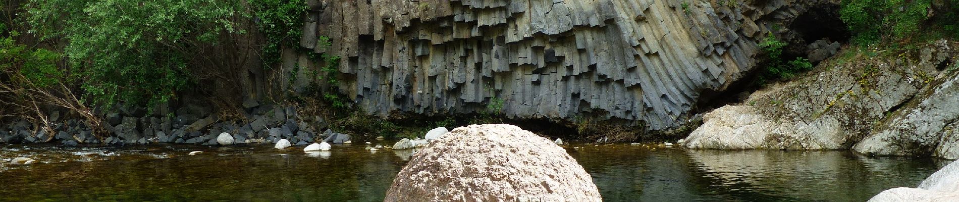
La Coupe de Jaujac, les orgues basaltiques, une leçon de géologie pour le plaisir de tous.
Photos


Positioning
Country:
France
Region :
Auvergne-Rhône-Alpes
Department/Province :
Ardèche
Municipality :
Jaujac
Location:
Unknown
Start:(Dec)
Start:(UTM)
599543 ; 4943330 (31T) N.
Comments