


Qu’oracles

memeche
User
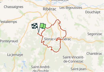

Length
26 km

Max alt
199 m

Uphill gradient
471 m
Km-Effort
33 km

Min alt
90 m

Downhill gradient
471 m
Boucle
Yes
Creation date :
2021-05-26 07:38:40.0
Updated on :
2021-05-26 10:55:58.837
3h16
Difficulty : Very easy

FREE GPS app for hiking
 SityTrail
IGN / Geographical institutes
SityTrail Plus
The world is yours!
About
Trail Mountain bike of 26 km to be discovered at New Aquitaine, Dordogne, Vanxains. This trail is proposed by memeche.
Positioning
Country:
France
Region :
New Aquitaine
Department/Province :
Dordogne
Municipality :
Vanxains
Location:
Unknown
Start:(Dec)
Start:(UTM)
289155 ; 5009613 (31T) N.
Comments