


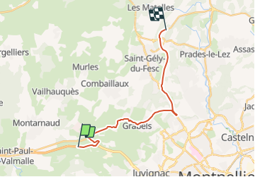
A 750 -GRABELS- ST GELY- LE LIEN -VENDARGUES-A709.

fb30
User


--
Difficulty : Very easy

FREE GPS app for hiking
 SityTrail
IGN / Geographical institutes
SityTrail Plus
The world is yours!
About
Trail Car of 18.9 km to be discovered at Occitania, Hérault, Montarnaud. This trail is proposed by fb30.
Description
Sortir A 750 à GRABELS-JUVIGNAC puis GRABELS (ATTENTION ! le pont sur la Mosson est très étroit et interdit au plus de 3.5 T) dans GRABELS tourner à gauche pour MONTFERRIER- ST GELY puis LE LIEN jusqu'à VENDARGUES et A709
Positioning
Comments