


Yport - Vattetot - Vaucottes / 12km - 300mDEN

philberard95
User
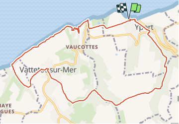

Length
12 km

Max alt
97 m

Uphill gradient
297 m
Km-Effort
15.9 km

Min alt
4 m

Downhill gradient
296 m
Boucle
Yes
Creation date :
2021-05-27 16:29:08.582
Updated on :
2021-07-02 16:16:13.886
3h37
Difficulty : Difficult

FREE GPS app for hiking
 SityTrail
IGN / Geographical institutes
SityTrail Plus
The world is yours!
About
Trail Walking of 12 km to be discovered at Normandy, Seine-Maritime, Yport. This trail is proposed by philberard95.
Positioning
Country:
France
Region :
Normandy
Department/Province :
Seine-Maritime
Municipality :
Yport
Location:
Unknown
Start:(Dec)
Start:(UTM)
306051 ; 5513161 (31U) N.
Comments