


Jarsaillon

Gegetop
User
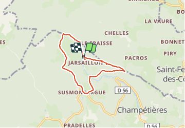

Length
6.6 km

Max alt
968 m

Uphill gradient
168 m
Km-Effort
8.8 km

Min alt
869 m

Downhill gradient
172 m
Boucle
Yes
Creation date :
2021-05-28 12:13:32.282
Updated on :
2021-05-29 08:37:54.939
1h30
Difficulty : Easy

FREE GPS app for hiking
 SityTrail
IGN / Geographical institutes
SityTrail Plus
The world is yours!
About
Trail Walking of 6.6 km to be discovered at Auvergne-Rhône-Alpes, Puy-de-Dôme, Champétières. This trail is proposed by Gegetop.
Description
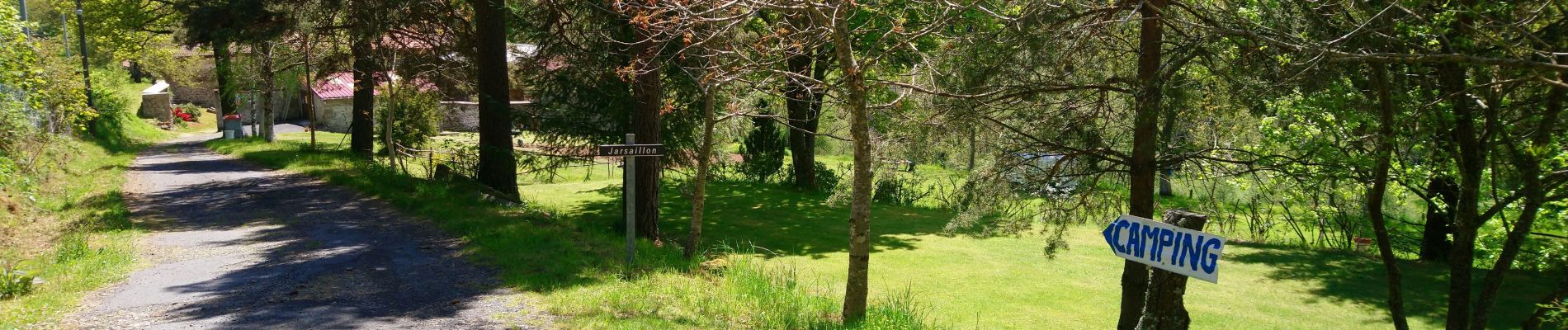
Petite boucle à travers les forêts de sapins.
Départ et retour au camping de Jarsaillon.
Photos

Positioning
Country:
France
Region :
Auvergne-Rhône-Alpes
Department/Province :
Puy-de-Dôme
Municipality :
Champétières
Location:
Unknown
Start:(Dec)
Start:(UTM)
552744 ; 5042295 (31T) N.
Comments