


St Jean-St Maurice 18km

thonyc
User GUIDE
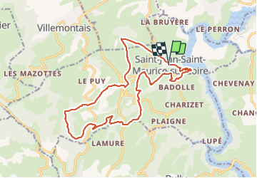

Length
18.3 km

Max alt
708 m

Uphill gradient
495 m
Km-Effort
25 km

Min alt
323 m

Downhill gradient
490 m
Boucle
Yes
Creation date :
2021-05-29 09:26:37.421
Updated on :
2021-06-07 05:24:44.355
5h55
Difficulty : Difficult

FREE GPS app for hiking
 SityTrail
IGN / Geographical institutes
SityTrail Plus
The world is yours!
About
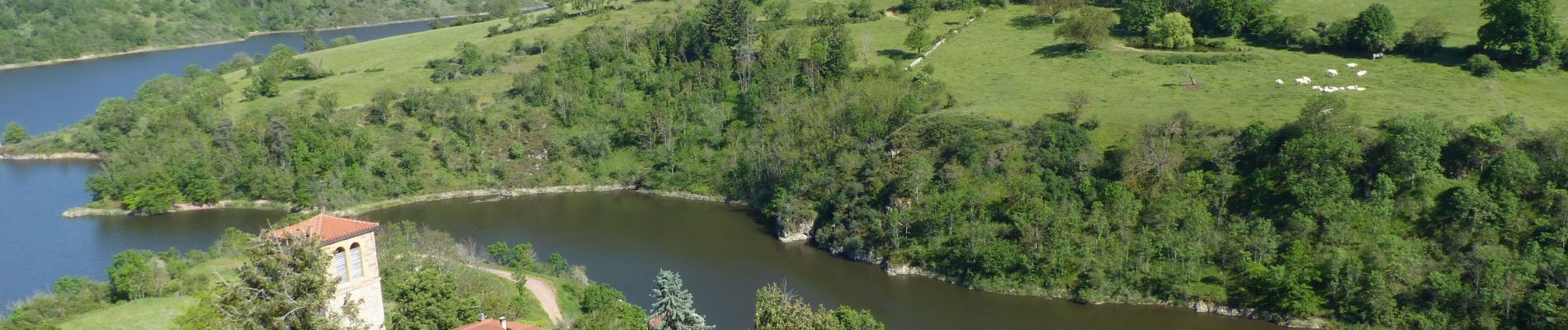
Trail Walking of 18.3 km to be discovered at Auvergne-Rhône-Alpes, Loire, Saint-Jean-Saint-Maurice-sur-Loire. This trail is proposed by thonyc.
Photos


Positioning
Country:
France
Region :
Auvergne-Rhône-Alpes
Department/Province :
Loire
Municipality :
Saint-Jean-Saint-Maurice-sur-Loire
Location:
Unknown
Start:(Dec)
Start:(UTM)
577686 ; 5090811 (31T) N.
Comments