


2021-05-29_20h40m58_12825609-track-1622313637-31

nouga
User
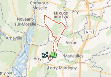

Length
10.2 km

Max alt
383 m

Uphill gradient
245 m
Km-Effort
13.5 km

Min alt
214 m

Downhill gradient
246 m
Boucle
Yes
Creation date :
2021-05-29 18:40:59.112
Updated on :
2021-05-29 18:40:59.595

FREE GPS app for hiking
 SityTrail
IGN / Geographical institutes
SityTrail Plus
The world is yours!
About
Trail of 10.2 km to be discovered at Grand Est, Moselle, Lorry-Mardigny. This trail is proposed by nouga.
Positioning
Country:
France
Region :
Grand Est
Department/Province :
Moselle
Municipality :
Lorry-Mardigny
Location:
Unknown
Start:(Dec)
Start:(UTM)
285723 ; 5430882 (32U) N.
Comments