


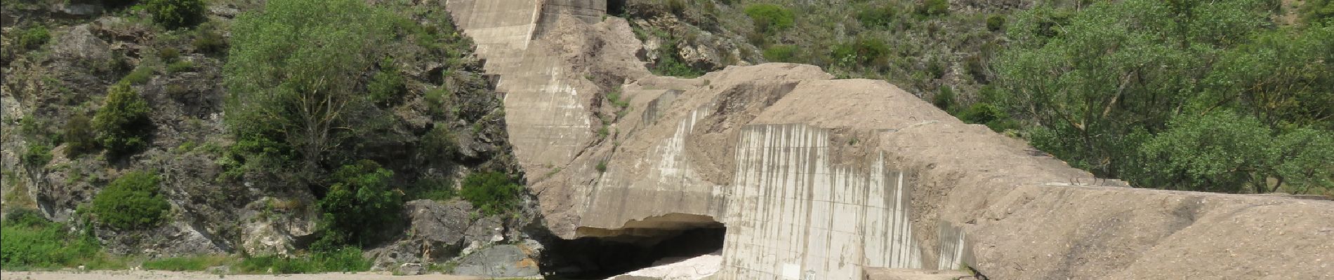
Esterel : barrage de Malpasset et lac de l'Avellan

aris
User
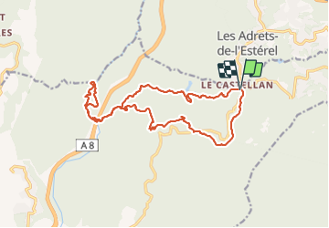

Length
19.1 km

Max alt
420 m

Uphill gradient
589 m
Km-Effort
27 km

Min alt
36 m

Downhill gradient
590 m
Boucle
Yes
Creation date :
2021-05-30 06:45:44.667
Updated on :
2021-05-30 15:26:51.032
6h14
Difficulty : Medium

FREE GPS app for hiking
 SityTrail
IGN / Geographical institutes
SityTrail Plus
The world is yours!
About
Trail Walking of 19.1 km to be discovered at Provence-Alpes-Côte d'Azur, Var, Fréjus. This trail is proposed by aris.
Description
Jolie randonnée de printemps, aucune difficulté. Vues spectraculaires sur les ruines du barrage.
Photos


Positioning
Country:
France
Region :
Provence-Alpes-Côte d'Azur
Department/Province :
Var
Municipality :
Fréjus
Location:
Unknown
Start:(Dec)
Start:(UTM)
323143 ; 4820129 (32T) N.
Comments