


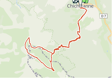
pas de l'Essaure

CABERMAT
User

Length
14.1 km

Max alt
1877 m

Uphill gradient
936 m
Km-Effort
27 km

Min alt
985 m

Downhill gradient
937 m
Boucle
Yes
Creation date :
2021-05-30 08:10:40.512
Updated on :
2021-05-30 16:10:32.244
5h06
Difficulty : Very difficult

FREE GPS app for hiking
 SityTrail
IGN / Geographical institutes
SityTrail Plus
The world is yours!
About
Trail Walking of 14.1 km to be discovered at Auvergne-Rhône-Alpes, Isère, Chichilianne. This trail is proposed by CABERMAT.
Positioning
Country:
France
Region :
Auvergne-Rhône-Alpes
Department/Province :
Isère
Municipality :
Chichilianne
Location:
Unknown
Start:(Dec)
Start:(UTM)
703547 ; 4965183 (31T) N.
Comments