


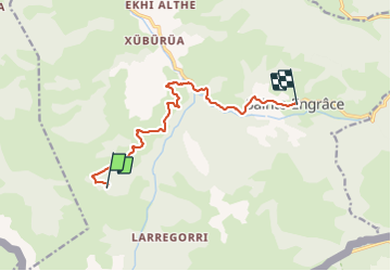
GR10 Cayolar d'Anhaou - Ste Engrace

winkelmuller
User

Length
10.9 km

Max alt
1265 m

Uphill gradient
197 m
Km-Effort
15.6 km

Min alt
463 m

Downhill gradient
822 m
Boucle
No
Creation date :
2021-06-03 06:15:10.997
Updated on :
2021-06-03 11:28:00.028
4h58
Difficulty : Difficult

FREE GPS app for hiking
 SityTrail
IGN / Geographical institutes
SityTrail Plus
The world is yours!
About
Trail Walking of 10.9 km to be discovered at New Aquitaine, Pyrénées-Atlantiques, Sainte-Engrâce. This trail is proposed by winkelmuller.
Positioning
Country:
France
Region :
New Aquitaine
Department/Province :
Pyrénées-Atlantiques
Municipality :
Sainte-Engrâce
Location:
Unknown
Start:(Dec)
Start:(UTM)
673650 ; 4760375 (30T) N.
Comments