


Entreves

Arthur Robin
User

Length
4.8 km

Max alt
3534 m

Uphill gradient
422 m
Km-Effort
10.5 km

Min alt
3253 m

Downhill gradient
456 m
Boucle
No
Creation date :
2021-06-03 07:26:24.462
Updated on :
2021-06-03 14:08:09.462
4h34
Difficulty : Difficult

FREE GPS app for hiking
 SityTrail
IGN / Geographical institutes
SityTrail Plus
The world is yours!
About
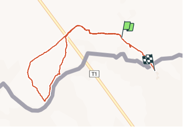
Trail Climbing of 4.8 km to be discovered at Auvergne-Rhône-Alpes, Upper Savoy, Chamonix-Mont-Blanc. This trail is proposed by Arthur Robin.
Positioning
Country:
France
Region :
Auvergne-Rhône-Alpes
Department/Province :
Upper Savoy
Municipality :
Chamonix-Mont-Blanc
Location:
Unknown
Start:(Dec)
Start:(UTM)
339118 ; 5079381 (32T) N.
Comments