


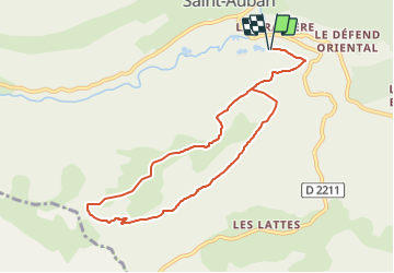
Les Pensiers de Saint Auban sans inverse des aiguilles d'une montre 3542 ET

verotrail
User

Length
9.6 km

Max alt
1602 m

Uphill gradient
573 m
Km-Effort
17.3 km

Min alt
1048 m

Downhill gradient
574 m
Boucle
Yes
Creation date :
2021-06-04 08:29:54.517
Updated on :
2021-09-23 09:40:39.032
3h55
Difficulty : Difficult

FREE GPS app for hiking
 SityTrail
IGN / Geographical institutes
SityTrail Plus
The world is yours!
About
Trail On foot of 9.6 km to be discovered at Provence-Alpes-Côte d'Azur, Maritime Alps, Saint-Auban. This trail is proposed by verotrail.
Positioning
Country:
France
Region :
Provence-Alpes-Côte d'Azur
Department/Province :
Maritime Alps
Municipality :
Saint-Auban
Location:
Unknown
Start:(Dec)
Start:(UTM)
317750 ; 4856946 (32T) N.
Comments