


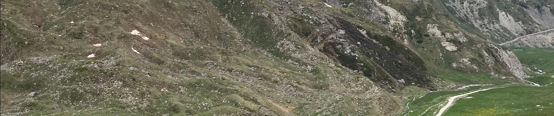
Lac de cerces

fb30
User
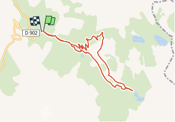

Length
10 km

Max alt
2428 m

Uphill gradient
444 m
Km-Effort
15.9 km

Min alt
2026 m

Downhill gradient
452 m
Boucle
Yes
Creation date :
2021-06-06 08:14:56.0
Updated on :
2021-06-06 16:14:22.254
4h12
Difficulty : Medium

FREE GPS app for hiking
 SityTrail
IGN / Geographical institutes
SityTrail Plus
The world is yours!
About
Trail Walking of 10 km to be discovered at Auvergne-Rhône-Alpes, Savoy, Valloire. This trail is proposed by fb30.
Photos

Positioning
Country:
France
Region :
Auvergne-Rhône-Alpes
Department/Province :
Savoy
Municipality :
Valloire
Location:
Unknown
Start:(Dec)
Start:(UTM)
298576 ; 4995873 (32T) N.
Comments