


Sentier des Lauzes 17km

thonyc
User GUIDE

Length
17 km

Max alt
757 m

Uphill gradient
659 m
Km-Effort
26 km

Min alt
376 m

Downhill gradient
666 m
Boucle
Yes
Creation date :
2021-06-06 08:14:20.591
Updated on :
2021-06-07 05:25:11.232
6h00
Difficulty : Difficult

FREE GPS app for hiking
 SityTrail
IGN / Geographical institutes
SityTrail Plus
The world is yours!
About
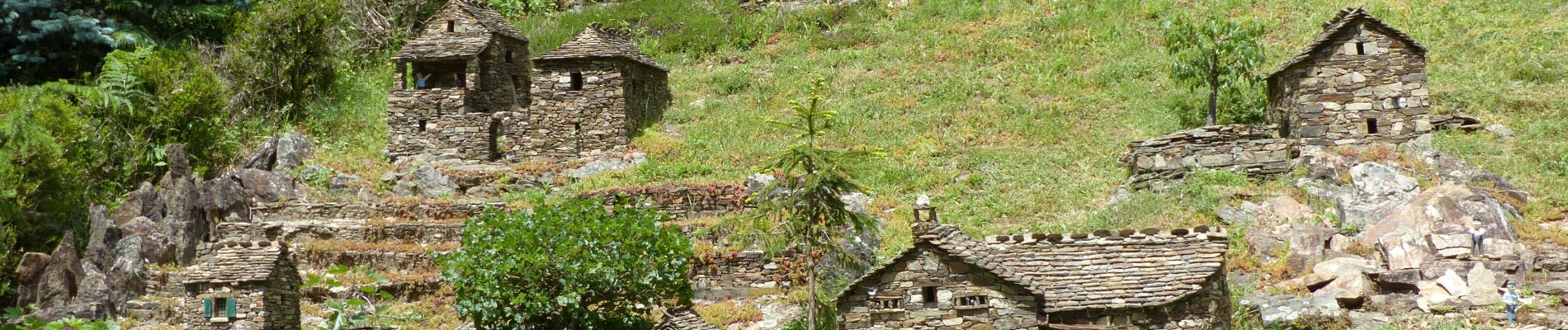
Trail Walking of 17 km to be discovered at Auvergne-Rhône-Alpes, Ardèche, Saint-Mélany. This trail is proposed by thonyc.
Photos


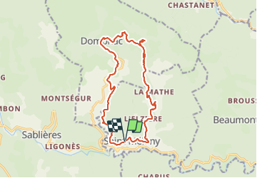
Positioning
Country:
France
Region :
Auvergne-Rhône-Alpes
Department/Province :
Ardèche
Municipality :
Saint-Mélany
Location:
Unknown
Start:(Dec)
Start:(UTM)
588567 ; 4931273 (31T) N.
Comments