


Balade autour du camping Escale Saint Giles

karani27
User

Length
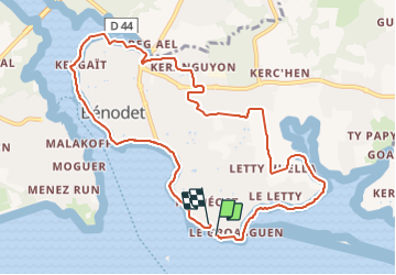
10.3 km

Max alt
26 m

Uphill gradient
96 m
Km-Effort
11.5 km

Min alt
-1 m

Downhill gradient
87 m
Boucle
Yes
Creation date :
2021-06-08 11:36:12.488
Updated on :
2021-06-11 20:20:43.205
2h45
Difficulty : Medium

FREE GPS app for hiking
 SityTrail
IGN / Geographical institutes
SityTrail Plus
The world is yours!
About
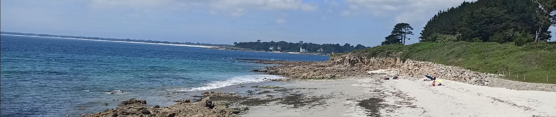
Trail Walking of 10.3 km to be discovered at Brittany, Finistère, Bénodet. This trail is proposed by karani27.
Photos


Positioning
Country:
France
Region :
Brittany
Department/Province :
Finistère
Municipality :
Bénodet
Location:
Unknown
Start:(Dec)
Start:(UTM)
418113 ; 5301515 (30T) N.
Comments