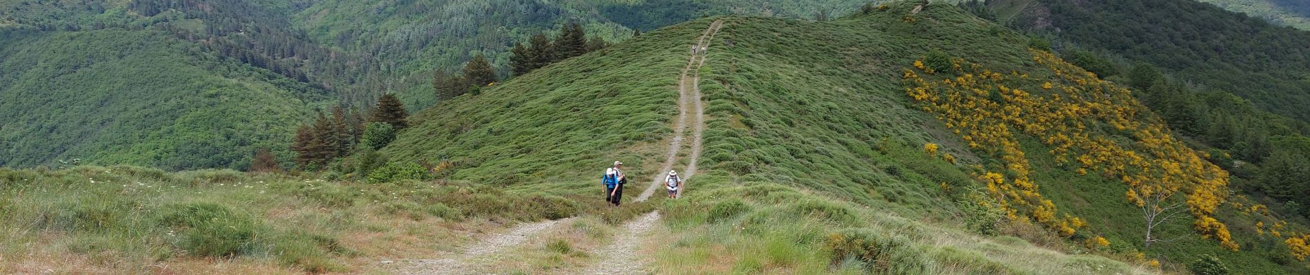
vers le St guiral puis le rocher de l'aigle

labarone
User
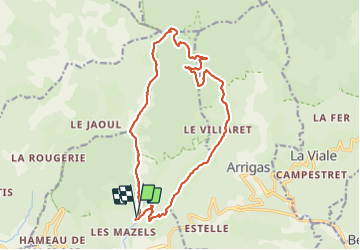

Length
17.7 km

Max alt
1340 m

Uphill gradient
877 m
Km-Effort
29 km

Min alt
614 m

Downhill gradient
879 m
Boucle
Yes
Creation date :
2021-06-08 07:23:21.855
Updated on :
2021-06-09 07:01:56.503
6h51
Difficulty : Difficult

FREE GPS app for hiking
 SityTrail
IGN / Geographical institutes
SityTrail Plus
The world is yours!
About
Trail Walking of 17.7 km to be discovered at Occitania, Gard, Alzon. This trail is proposed by labarone.
Description
de bons dénivelés au départ puis le long des crêtes.. belle rando
Photos


Positioning
Country:
France
Region :
Occitania
Department/Province :
Gard
Municipality :
Alzon
Location:
Unknown
Start:(Dec)
Start:(UTM)
535501 ; 4869421 (31T) N.
Comments