


plaone

Martelpierre
User
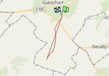

Length
3.9 km

Max alt
99 m

Uphill gradient
19 m
Km-Effort
4.2 km

Min alt
84 m

Downhill gradient
19 m
Boucle
Yes
Creation date :
2021-06-09 18:43:52.985
Updated on :
2021-06-09 19:26:33.782
40m
Difficulty : Easy
39m
Difficulty : Easy

FREE GPS app for hiking
 SityTrail
IGN / Geographical institutes
SityTrail Plus
The world is yours!
About
Trail Walking of 3.9 km to be discovered at Hauts-de-France, Somme, Gueschart. This trail is proposed by Martelpierre.
Positioning
Country:
France
Region :
Hauts-de-France
Department/Province :
Somme
Municipality :
Gueschart
Location:
Unknown
Start:(Dec)
Start:(UTM)
429865 ; 5565101 (31U) N.
Comments