


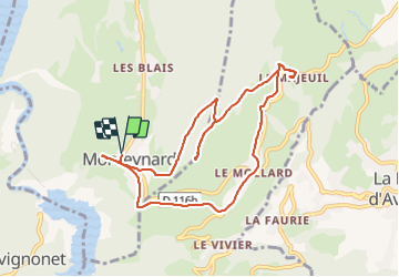
Monteynard la ville - Le Majeuil

maupassant38
User

Length
9.7 km

Max alt
1164 m

Uphill gradient
510 m
Km-Effort
16.5 km

Min alt
775 m

Downhill gradient
509 m
Boucle
Yes
Creation date :
2021-06-10 08:49:03.071
Updated on :
2021-06-10 12:41:22.392
2h19
Difficulty : Medium

FREE GPS app for hiking
 SityTrail
IGN / Geographical institutes
SityTrail Plus
The world is yours!
About
Trail Walking of 9.7 km to be discovered at Auvergne-Rhône-Alpes, Isère, Monteynard. This trail is proposed by maupassant38.
Positioning
Country:
France
Region :
Auvergne-Rhône-Alpes
Department/Province :
Isère
Municipality :
Monteynard
Location:
Unknown
Start:(Dec)
Start:(UTM)
712974 ; 4982762 (31T) N.
Comments