


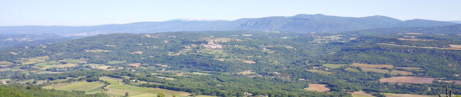
Mourre du Grd Lubéron, crêtes et versant Nord

MarcLEBARON
User


6h00
Difficulty : Difficult

FREE GPS app for hiking
 SityTrail
IGN / Geographical institutes
SityTrail Plus
The world is yours!
About
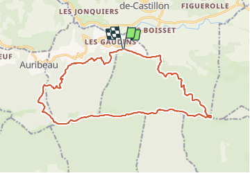
Trail Walking of 21 km to be discovered at Provence-Alpes-Côte d'Azur, Vaucluse, Castellet-en-Luberon. This trail is proposed by MarcLEBARON.
Description
boucle au départ du parking lieu-dit Raymondette jusqu'au crêtes (cote 939).
Poursuivre sur les crêtes jusqu'à la tour télécom du Mourre Nègre (type montagne russe).
Redescente vers le Castellet (descente un peu exigeante, ravinée et pierreuse).
La partie d'évitement du Castellet jusqu'au Gaudins n'est pas évidente (sentier trace pas simple à trouver et suivre...peut être à éviter.
Photos


Positioning
Comments