


Vallée des Tuiliers 14km

thonyc
User GUIDE
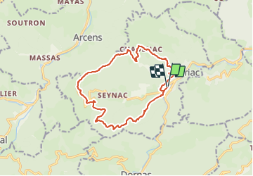

Length
15.6 km

Max alt
998 m

Uphill gradient
591 m
Km-Effort
24 km

Min alt
540 m

Downhill gradient
590 m
Boucle
Yes
Creation date :
2021-06-10 08:05:30.034
Updated on :
2021-06-11 05:50:42.584
6h16
Difficulty : Medium

FREE GPS app for hiking
 SityTrail
IGN / Geographical institutes
SityTrail Plus
The world is yours!
About
Trail Walking of 15.6 km to be discovered at Auvergne-Rhône-Alpes, Ardèche, Mariac. This trail is proposed by thonyc.
Description
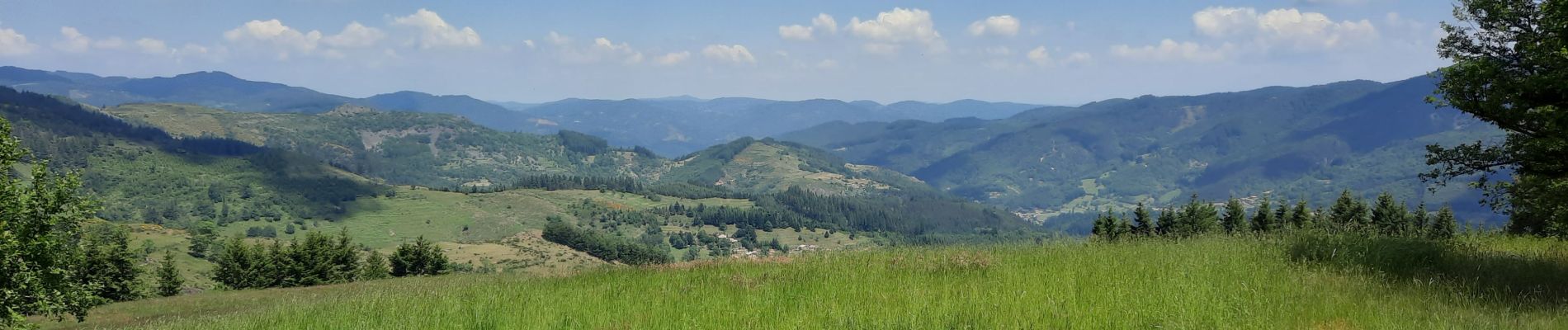
Très jolis panoramas
Visiter Girond, superbe !
Photos


Positioning
Country:
France
Region :
Auvergne-Rhône-Alpes
Department/Province :
Ardèche
Municipality :
Mariac
Location:
Unknown
Start:(Dec)
Start:(UTM)
607981 ; 4970927 (31T) N.
Comments