


Navacelle (à modifier)

Atchoum26
User
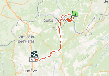

Length
57 km

Max alt
732 m

Uphill gradient
1150 m
Km-Effort
73 km

Min alt
227 m

Downhill gradient
1282 m
Boucle
No
Creation date :
2021-06-10 08:39:16.371
Updated on :
2021-06-10 17:51:34.775
2h30
Difficulty : Easy

FREE GPS app for hiking
 SityTrail
IGN / Geographical institutes
SityTrail Plus
The world is yours!
About
Trail Walking of 57 km to be discovered at Occitania, Hérault, Saint-Maurice-Navacelles. This trail is proposed by Atchoum26.
Positioning
Country:
France
Region :
Occitania
Department/Province :
Hérault
Municipality :
Saint-Maurice-Navacelles
Location:
Unknown
Start:(Dec)
Start:(UTM)
540459 ; 4860275 (31T) N.
Comments