


11 juin 21

Nila81
User
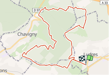

Length
14.2 km

Max alt
423 m

Uphill gradient
317 m
Km-Effort
18.4 km

Min alt
291 m

Downhill gradient
319 m
Boucle
Yes
Creation date :
2021-06-11 11:39:41.213
Updated on :
2021-06-11 14:46:48.415
3h05
Difficulty : Difficult

FREE GPS app for hiking
 SityTrail
IGN / Geographical institutes
SityTrail Plus
The world is yours!
About
Trail Walking of 14.2 km to be discovered at Grand Est, Meurthe-et-Moselle, Ludres. This trail is proposed by Nila81.
Description
a l'ombre
Positioning
Country:
France
Region :
Grand Est
Department/Province :
Meurthe-et-Moselle
Municipality :
Ludres
Location:
Unknown
Start:(Dec)
Start:(UTM)
290572 ; 5388875 (32U) N.
Comments