


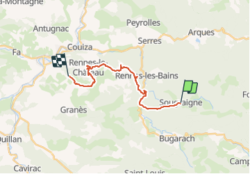
Sougraigne Rennes le Château Pailhères

alinetpierre
User

Length
20 km

Max alt
551 m

Uphill gradient
570 m
Km-Effort
28 km

Min alt
326 m

Downhill gradient
595 m
Boucle
No
Creation date :
2021-06-12 06:11:32.183
Updated on :
2021-06-12 14:23:50.623
5h16
Difficulty : Medium

FREE GPS app for hiking
 SityTrail
IGN / Geographical institutes
SityTrail Plus
The world is yours!
About
Trail Walking of 20 km to be discovered at Occitania, Aude, Sougraigne. This trail is proposed by alinetpierre.
Description
Sur les sentiers Cathares , attention beaucoup de bitume.
Positioning
Country:
France
Region :
Occitania
Department/Province :
Aude
Municipality :
Sougraigne
Location:
Unknown
Start:(Dec)
Start:(UTM)
447317 ; 4750120 (31T) N.
Comments