


Parc des Iles Hennin Drocourt

avdem
User
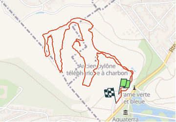

Length
3.5 km

Max alt
94 m

Uphill gradient
91 m
Km-Effort
4.7 km

Min alt
40 m

Downhill gradient
93 m
Boucle
Yes
Creation date :
2021-06-13 08:08:05.792
Updated on :
2021-06-13 09:29:20.953
1h04
Difficulty : Easy

FREE GPS app for hiking
 SityTrail
IGN / Geographical institutes
SityTrail Plus
The world is yours!
About
Trail Walking of 3.5 km to be discovered at Hauts-de-France, Pas-de-Calais, Hénin-Beaumont. This trail is proposed by avdem.
Description
onteressant
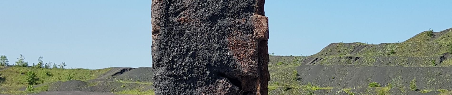
Photos


28 photos in total. Please click on a photo to see them all in the gallery.
Positioning
Country:
France
Region :
Hauts-de-France
Department/Province :
Pas-de-Calais
Municipality :
Hénin-Beaumont
Location:
Unknown
Start:(Dec)
Start:(UTM)
494747 ; 5583714 (31U) N.
Comments