Trail Walking Saint-Étienne-de-Tinée - 
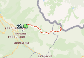
Lacs de Colle Longue depuis Douans - Photo
 aris
aris

User

© OpenStreetMap contributors
Length
Length
15.5 km
Max alt
Max alt
2550 m
Uphill gradient
Uphill gradient
1231 m
Km-Effort
Km-Effort  
32 km
Min alt
Min alt
1446 m
Downhill gradient
Downhill gradient
1228 m
Boucle
Boucle
Yes
Creation date :
2021-06-13 07:05:27.012
Updated on :
2021-06-13 17:43:41.557

(0 Reviews)

Walking
Walking
6h10
Difficulty : Difficult

Scan this QR Code to open this trail in the SityTrail application

FREE GPS app for hiking

Logo SityTrail SityTrail

IGN / Geographical institutes

Download SityTrail from the App Store Download SityTrail from Google Play

Logo SityTrail SityTrail Plus

The world is yours!

Download SityTrail from the App Store Download SityTrail from Google Play Download SityTrail on Huawei AppGallery

About

Trail Walking of 15.5 km to be discovered at Provence-Alpes-Côte d'Azur, Maritime Alps, Saint-Étienne-de-Tinée. This trail is proposed by aris.

Description

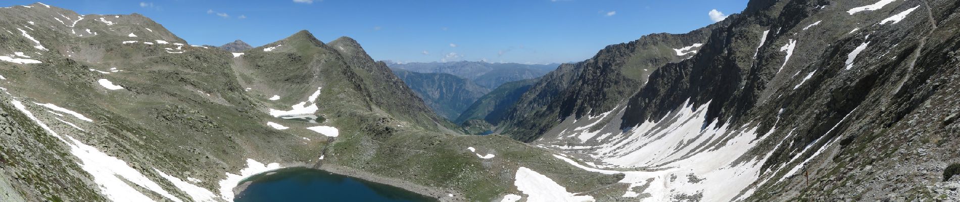
Randonnée facile, un peu longue (cotation difficile pour le dénivelé et la longueur). Il est possible de se garer au bout de la piste au dessus de Douans. Très belles vues en arrivant sur la crête et au pas de Colle-Longue. Le lac supérieur est encore partiellement enneigé en cette mi-Juin.

Elevation profile

Photos

Positioning

Country:
France
Region :
Provence-Alpes-Côte d'Azur
Department/Province :
Maritime Alps
Municipality :
Saint-Étienne-de-Tinée
Location:
Unknown
Start:(UTM)
338225 ; 4898685 (32T) N.


Close
My subscriptions