


5555

raab
User

Length
15 km

Max alt
981 m

Uphill gradient
775 m
Km-Effort
25 km

Min alt
403 m

Downhill gradient
702 m
Boucle
No
Creation date :
2021-04-15 06:50:12.993
Updated on :
2021-06-14 08:52:11.05
8h02
Difficulty : Very difficult

FREE GPS app for hiking
 SityTrail
IGN / Geographical institutes
SityTrail Plus
The world is yours!
About
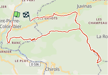
Trail Walking of 15 km to be discovered at Auvergne-Rhône-Alpes, Ardèche, Saint-Pierre-de-Colombier. This trail is proposed by raab.
Positioning
Country:
France
Region :
Auvergne-Rhône-Alpes
Department/Province :
Ardèche
Municipality :
Saint-Pierre-de-Colombier
Location:
Unknown
Start:(Dec)
Start:(UTM)
600193 ; 4950925 (31T) N.
Comments