


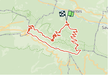
Brantes-Ventoux-Frache-Brantes-Bis

MarcLEBARON
User


8h02
Difficulty : Difficult

FREE GPS app for hiking
 SityTrail
IGN / Geographical institutes
SityTrail Plus
The world is yours!
About
Trail Walking of 28 km to be discovered at Provence-Alpes-Côte d'Azur, Vaucluse, Brantes. This trail is proposed by MarcLEBARON.
Description
Rando versant nord en milieu forestier, et crête du Ventoux (magnifiques paysages de forêt et pierriers.. animaux).
La partie redescente en dessous du pas de la Frache de la côte 1450 à 1100 se fait en sentier "trâce" à gibier plutôt trâce que sentier et ensuite sur piste un peu monotone en fin de rando.
Photos


Positioning
Comments