


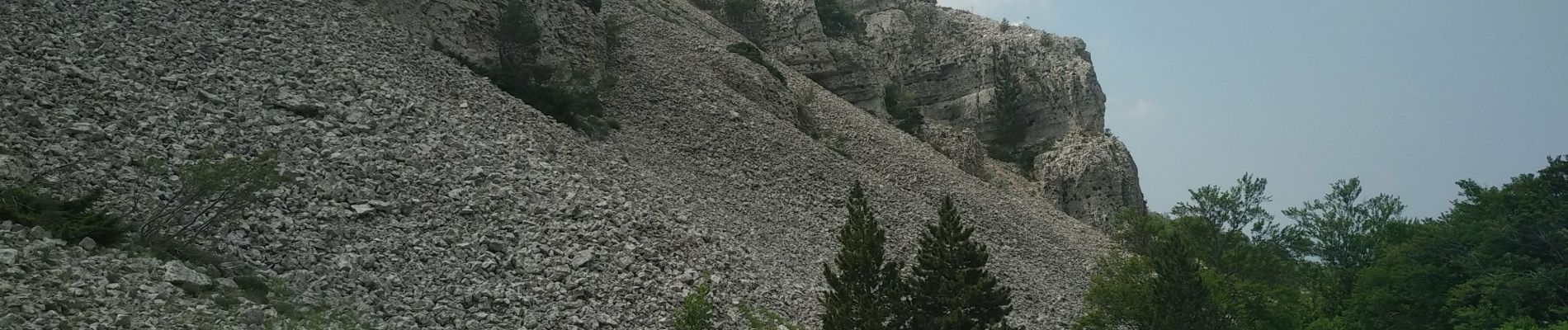
MT Ventoux ST Colombe 15 juin 2021 (IBP 132) CAF

TRIMAILLE
User
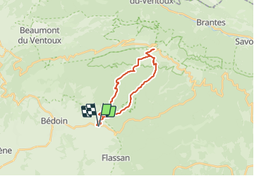

Length
22 km

Max alt
1910 m

Uphill gradient
1455 m
Km-Effort
41 km

Min alt
458 m

Downhill gradient
1455 m
Boucle
Yes
Creation date :
2021-06-15 04:09:25.978
Updated on :
2021-06-22 16:18:19.205
6h24
Difficulty : Difficult

FREE GPS app for hiking
 SityTrail
IGN / Geographical institutes
SityTrail Plus
The world is yours!
About
Trail Walking of 22 km to be discovered at Provence-Alpes-Côte d'Azur, Vaucluse, Bédoin. This trail is proposed by TRIMAILLE.
Photos
 CAF - Photo 1")
 CAF - Photo 2")
 CAF - Photo 3")
 CAF - Photo 4")
 CAF - Photo 5")
 CAF - Photo 6")
 CAF - Photo 7")
 CAF - Photo 8")
 CAF - Photo 9")
 CAF - Photo 10")
 CAF - Photo 11")
 CAF - Photo 12")
Positioning
Country:
France
Region :
Provence-Alpes-Côte d'Azur
Department/Province :
Vaucluse
Municipality :
Bédoin
Location:
Unknown
Start:(Dec)
Start:(UTM)
678035 ; 4887635 (31T) N.
Comments